Wetlands – Six wetlands were identified and delineated within the project corridor by PennDOT’s consultant. Four of the wetlands were characterized as forested wetlands and the remaining two were identified as wetlands dominated by emergent vegetation. Wetlands ranged in size from 0.01 to 0.16 acres in size.
Streams – The Neshaminy Creek is a major perennial watercourse that flows from west to east through the northern portion of the U.S. 1 project corridor. The Neshaminy Creek is classified as a Warm Water Fishery (WWF) with an average water depth of three feet and an average stream width of 216 feet.
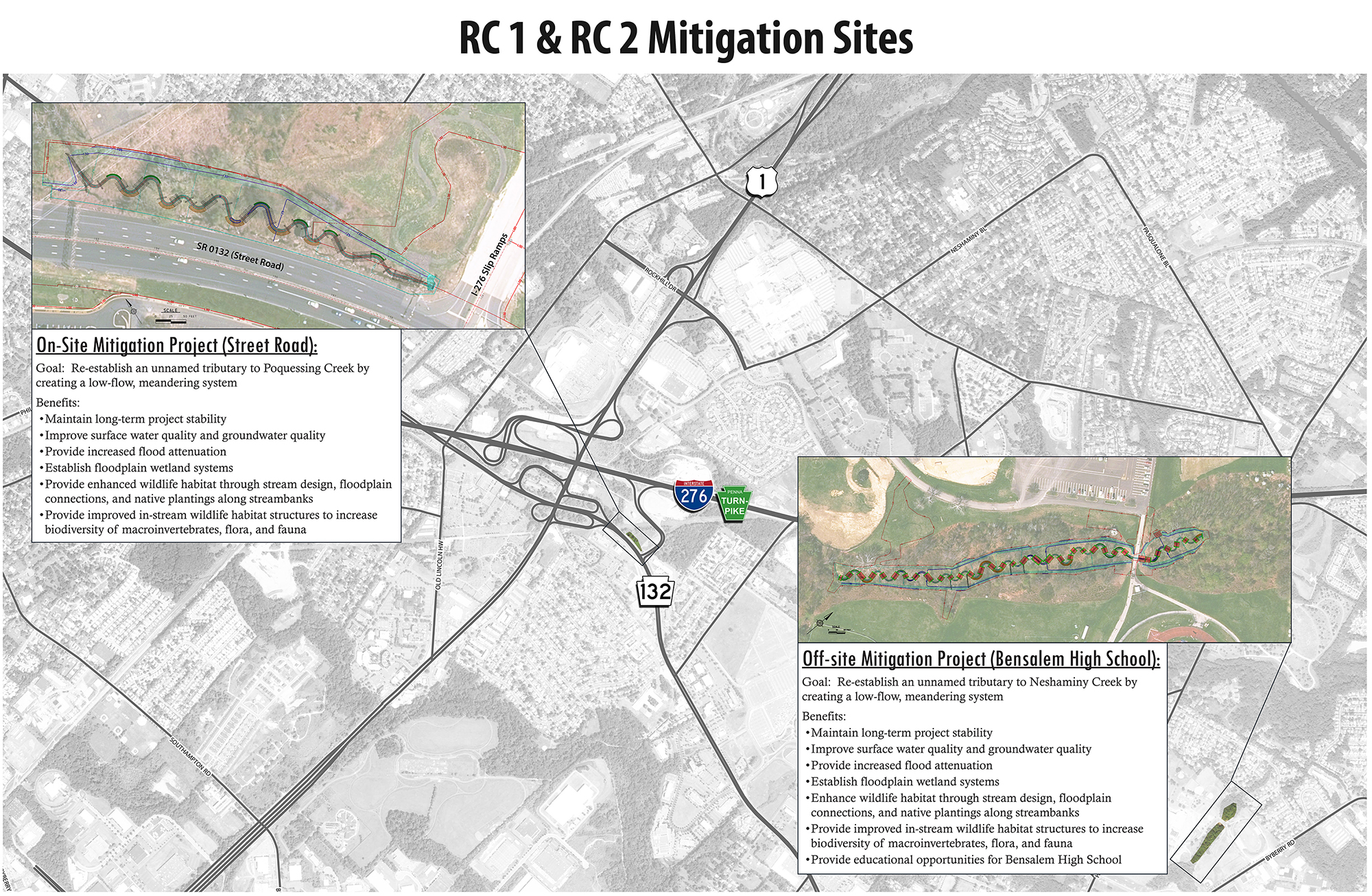
Project alternatives were identified and developed to avoid and minimize impacts to the wetlands and streams within the U.S. 1 project corridor, sections RC1 and RC2. Unavoidable impacts require mitigation through the replacement of wetland and stream resources. PennDOT identified two mitigation sites to offset impacts to wetlands and streams as a result of the U.S. 1, Sections RC1 and RC2 improvements. One On-site Mitigation area located off Street Road and one Off-site Mitigation site located at Bensalem High School.